
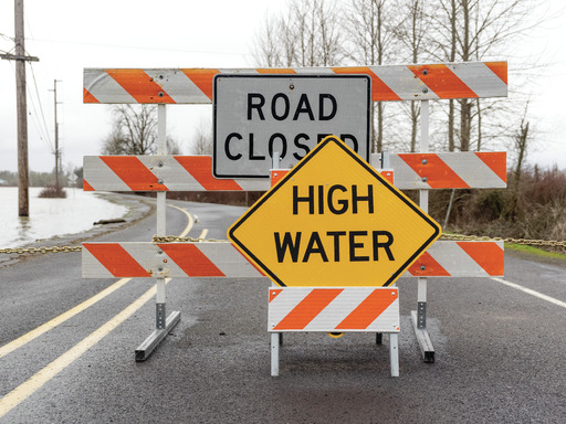

STERLING VA: (ROCKTOWN NOW) – The National Weather Service has issued a Flood Watch for tonight and early Saturday. The Flood Watch includes portions of Virginia, West Virginia, and Maryland from this evening through late tonight, warning residents of the possibility of flash flooding due to excessive rainfall. A slow-moving frontal system is expected to bring multiple rounds of showers and thunderstorms, shifting into moderate to heavy rain as the evening progresses. Forecasts indicate storm totals could reach 2 to 3 inches, with some areas seeing nearly 4 inches of rainfall. This could lead to dangerous runoff, flooding rivers, creeks, and low-lying areas.
Regions at Risk
The Flood Watch covers multiple counties across north-central Maryland, northern Virginia, and eastern West Virginia, including Augusta, Frederick, Rockingham, and Shenandoah in Virginia; Berkeley, Grant, Hampshire, and Hardy in West Virginia; and parts of Washington County, Maryland.
Potential Impacts
Officials warn that excessive runoff could lead to flooding in urban areas, poor drainage zones, and low-lying locations. Residents are urged to exercise caution, avoid flooded roadways, and stay informed as the situation develops. Residents can find safety tips and preparedness information at the National Weather Service’s website: www.weather.gov/safety/flood