


HARRISONBURG VA: (Rocktown Now) – Temperatures should reach into the forties today and maybe hit the low fifties in some parts of the Shenandoah Valley. Clouds move in and the temperatures will be cooler starting Thursday, slowing the melting of the ice/snow mess covering the ground. While we all want to the snow to melt, it may be better that we slow the process, with the approach of another system this weekend. Rain will be possible from late Saturday night through the day on Sunday. The rain combined with the melting snow could lead to flooding issues, if the snow melt happens too quickly.
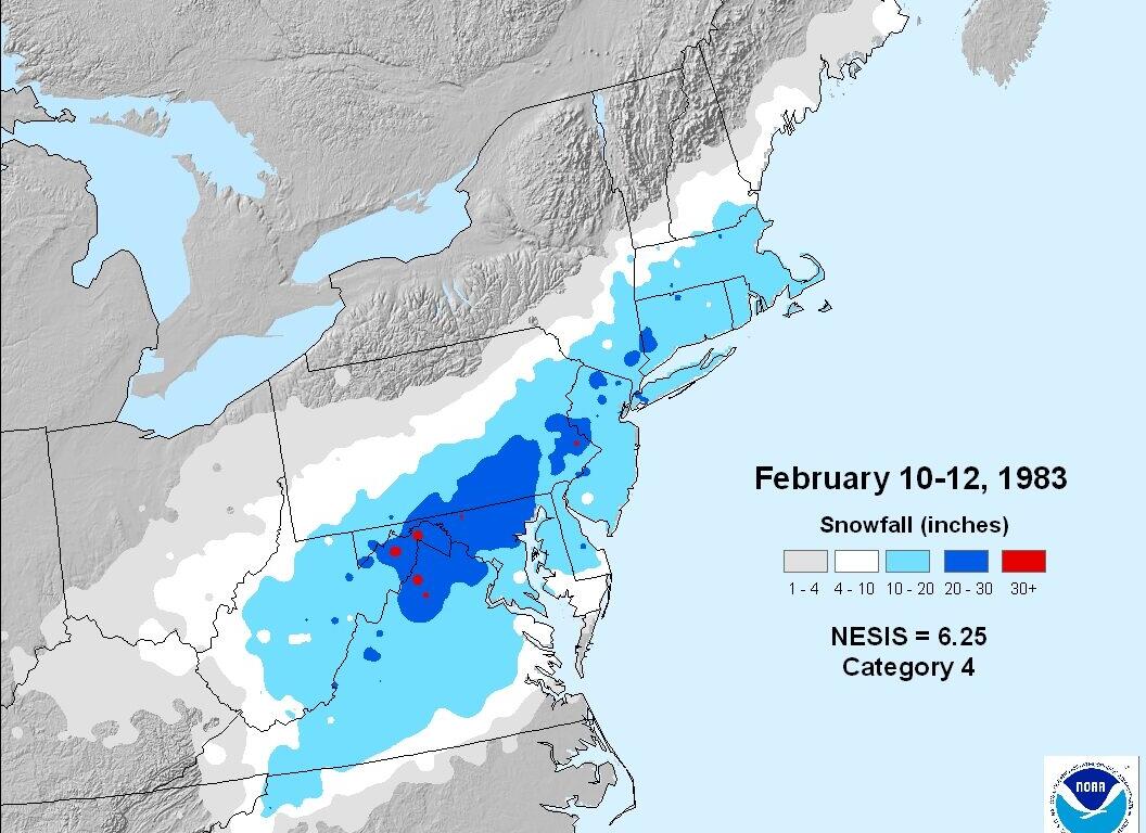
Anniversary of the 1983 snowstorm
On this date in 1983 the east coast weather was being influenced by an of a strong El Niño, which lead to cold and wet weather across the southern United States. A storm forming on February 11th would bring Blizzard like conditions and heavy snow to the Shenandoah Valley. The heaviest snowfall recorded in the valley was in Woodstock with 32 inches. Dale Enterprise, west of Harrisonburg, recorded 20 inches of snow. The gusty winds caused major drifts and closed many roads, including Route 33 west of the city.
Here’s the WSVA exclusive AccuWeather forecast
Tonight: partly cloudy and breezy. Low 29. Winds northwest 10-20 mph.
Tomorrow: colder with intervals of clouds and sunshine. High 38. Winds northwest 7-14 mph.
Tomorrow night: clearing. Low 19. Winds northwest 4-8 mph.
Friday: mostly sunny. High 44. Winds northwest 4-8 mph.
Saturday: sunny to partly cloudy and not as cool. High 56. Winds south-southwest 3-6 mph.
Sunday: colder with a chance for rain and snow. High 39. Winds light and variable.
Sunset today will be at 5:49 p.m.
Sunrise Thursday will be at 7:09 a.m.
Historical weather data for this date at the Dale Enterprise Weather Station
High: 79 in 1932
Low: -22 in 1899
Precipitation: 1.07 in 1925
Snowfall: 20.0 in 1993