


HARRISONBURG VA: (Rocktown Now) – A powerful winter storm is forecast to sweep across the Mid-Atlantic beginning Saturday afternoon, bringing the potential for significant snowfall, dangerous ice, and bitterly cold temperatures through late Sunday night. The National Weather Service has issued a Winter Storm Watch for much of Maryland, Virginia, and the eastern panhandle of West Virginia.
Forecasters warn that a large shield of precipitation will move into the region as Arctic air remains firmly in place, setting the stage for widespread wintry weather. Snow is expected to begin overspreading the area by Saturday evening and could quickly intensify.
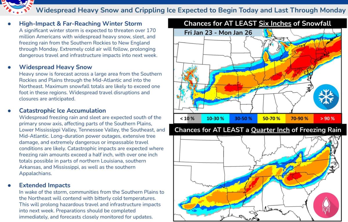
According to the Weather Service, there is a high likelihood of at least five inches of snow, with amounts exceeding 10 inches possible in some locations. Snowfall rates of one to two inches per hour may develop Saturday night, creating rapidly deteriorating travel conditions.
On Sunday, temperatures hovering near the freezing mark may cause the snow to transition to sleet or freezing rain, especially south of Interstate 70 and near or east of Interstate 95. Areas across central Virginia face the highest risk for significant icing, which could lead to hazardous roads and potential power outages.
Visibility may drop to a quarter-mile or less at times due to heavy snowfall.
Beyond the storm itself, the region is bracing for a prolonged stretch of dangerously cold weather. Wind chills in the teens and single digits are expected from Friday night through the middle of next week, with sub-zero wind chills possible at times.
Officials urge residents to prepare now. The Weather Service recommends stocking up on essential groceries and medications before conditions deteriorate. Travelers are advised to keep an emergency kit in their vehicles, including flashlights, extra batteries, blankets, and a full tank of gas or fully charged battery for electric vehicles.
Residents are also encouraged to check on elderly neighbors, friends, and family members, and to take precautions for pets and livestock during the extended cold snap.
The Winter Storm Watch remains in effect from Saturday afternoon through late Sunday night, and forecasters caution that further updates are likely as the storm approaches.