
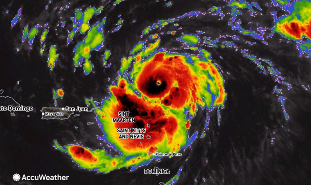

HARRISONBURG VA: (ROCKTOWN NOW) – Erin has quickly strengthened into a Category 5 hurricane as it moves northward through the Atlantic Ocean. Forecast models show the storm tracking away from the U.S. East Coast, with its center expected to pass near Bermuda next Wednesday and Thursday. While Erin’s outer bands may bring rip currents and minor coastal effects to parts of the East Coast, Virginia—especially inland areas like the Shenandoah Valley—is not in the storm’s direct path.
Local Weather Impacts
Although Erin itself is staying offshore, a marginal flash flood threat was issued for parts of southwest and central Virginia, including areas near the Shenandoah Valley. This is due to isolated thunderstorms and heavy rainfall unrelated to Erin but part of a broader unsettled weather pattern. Residents should remain alert for localized flooding, especially in low-lying and urban areas.

Forecast Outlook
The weekend forecast for the Shenandoah Valley includes hot and humid conditions. Temperatures reaching into the upper 80s and low 90s. Scattered thunderstorms are possible, particularly on Saturday. No severe weather directly tied to Hurricane Erin is expected.
Summary
While Hurricane Erin has become a powerful storm, its northward turn in the Atlantic has spared Virginia from significant impacts. The Shenandoah Valley will continue to experience typical summer weather, with some rain and heat, but no hurricane-related disruptions are forecast at this time.